The Tarva archipelago provides a magical coastal experience. This is a child friendly bicycle trip in scenic surroundings. The archipelago is protected and has several sites with remains from the WWII occupation of the area. The total land area of the islands is only 14 square km (5.4 sq. miles) where Husøya island is the largest and contributes about half of the area. The island is void of trees and is a rich bird habitat. The island is inhabited and the main occupation is sheep farming. The coastal moorland has been used as year-round grazing for 4000 years. The special landscape combined with WWII remnants, archeological sites and a rich flora makes a trip here more than worthwile.
The air force maintains a shooting range on a closed off area of the islands. It is important to stay on the road both due to the possibilty of military excercises as well as not to disturb nesting birds.
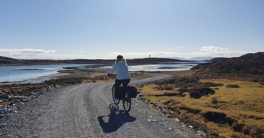
There are several beautiful picnic spots so pack food and drink and experience the fantastic nature and history of the archipelago of Tarva.
There's a good possibility that you will spot White-tailed eagles during your visit.
The route: The trip starts from the ferry dock and you bike north on the main road towards Valøya island. After about half a km (550 yards) you will get to a crossroad by the Tarvagården farm. If you go west you will end up at the military's shooting range and by Karlsøyvalen, the sound between Husøya and Karlsøya islands, you will find a beautiful picnic spot by the beach. At the end of the road you will find and observation post. Bring a pair of binoculars as there is a good chance you will spot lots of eagles.
You can return to the crossroad and continue to Tarvagården farm which was part of Austrått manor until 1858. In 1900 the farm had 16 crofts connected to the farm. Today the farm raises cattle and sheep. About 1 km from the farm you will find Tarva school house next to a 50 year old spruce forest. The spruce is an invasive species in Tarva as it has a tendency to cover the moors. Behind the forest you will see many tree stumps which is part of a project to remove the forest. Both the school grounds and the forested area was a now cleared mine field during the war. Tarva is one of 22 chosen areas in Norway designated cultural landscape of particular value.
Further down the road you will arrive at an area (Åkervika bay to Grønndalen valley) which during WWII was fortified with barbed wire and anti-personnel mines. At the peak of activity there were about 2000 soldiers stationed here. The grave yard of Nordbuan was establised in 1921 and the nearby chapel was erected in 1972. You will find lots of WWII remnants in this area: ammunition bunker, concrete road build specifially to transport three large battleship cannons (28 cm barrel opening), dock facilities at Myravågen (North harbour) and the mammoth bunker by Grønndalen valley (was the foundation for a giant radar (30 m x 16 m). The three cannons were placed side by side by Valøya island. The cannon closest to the road exploded during a test firing excercise after the war: six Germans and 2 Norwegians died during the explosion. Many of the bunkers are open so bring a flashlight if you'd like to explore. At the summit of Valøya island there is an excellent view of the area. North of the summit a path with stairs takes you to some WWII grafitti.
From Valøya island you will follow the main road back to the ferry dock.
Praktiske opplysninger:
Child friendly
Public toilet at the school building at the center of the island.
Many signposts available
Ferry schedule to and from Dypfest and Tarva: AtB
Several nice spots for taking a swim
No shops or gas stations so bring your own supplies